


Google Maps is a web-based service that offers detailed geographical information and various features such as real-time traffic conditions, route planning for travel by foot, car, bicycle, and air, as well as business locations. It was launched in 2005 by Google and has since become one of the most widely used mapping services globally.
Google Maps provides users with satellite imagery, street maps, panoramic views of streets (via Google Street View), and real-time traffic updates. It has been integrated into numerous applications and websites, making it a versatile tool for various navigation and informational purposes.
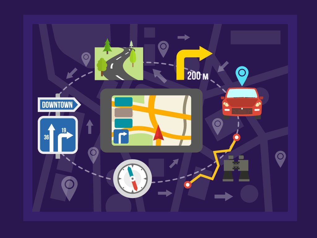
How to Use Google Maps
1. Accessing Google Maps: Google Maps can be accessed via a web browser at maps.google.com or through the Google Maps mobile app, which is available for both Android and iOS devices. Upon opening Google Maps, users are presented with a map interface showing their current location if location services are enabled.
2. Searching for Locations: The search bar at the top of the interface allows users to type in an address, landmark, business name, or type of business. As the user types, suggestions are provided to facilitate quick and accurate searches.
3. Navigating the Map: Users can zoom in and out using the zoom buttons or by pinching the screen on mobile devices. Dragging the map is done by clicking and holding the mouse button on a desktop or swiping on a mobile device. Different layers, such as satellite view or terrain, can be selected to provide more detailed information.
4. Getting Directions: To get directions, the “Directions” button is clicked, followed by entering the starting point and destination. The preferred mode of transportation (walking, driving, bicycling, or public transport) can then be selected. The best routes are provided along with estimated travel times. Traffic conditions and alternative routes are also shown.
5. Using Street View: Google Street View can be accessed by dragging the Pegman icon (found in the bottom right corner) onto a location on the map. This feature allows users to view panoramic street-level images, giving a real-world perspective of locations.
6. Saving and Sharing Locations: Locations can be saved by clicking on them and selecting “Save” to add them to lists like “Favorites” or “Want to Go”. Locations can also be shared by clicking the “Share” button to generate a link that can be sent to others.
7. Contributing to Google Maps: Users can contribute by adding reviews, photos, and missing places. This is done by selecting a location and using the “Write a review” or “Add a photo” options. Contributions help improve the accuracy and usefulness of the map.
Pros of Google Maps
1. Comprehensive and Detailed Information: Google Maps offers extensive geographical information, including addresses, business locations, contact information, and reviews. The detail provided is unparalleled and continually updated.
2. Real-Time Traffic Updates: Real-time traffic conditions and alternative route suggestions help users avoid congestion and save time. Traffic data is updated frequently to provide the most accurate information possible.
3. Multiple Transportation Modes: Directions for various transportation modes, including driving, walking, biking, and public transit, are provided. This flexibility accommodates different user needs and preferences.
4. Street View: Street View provides panoramic, street-level images, allowing users to virtually explore neighborhoods and landmarks. This feature is particularly useful for familiarizing oneself with a location before visiting.
5. Integration with Other Services: Google Maps is integrated with many other Google services, such as Google Search and Google Calendar, enhancing its functionality. It is also used by numerous third-party applications and websites.
6. Offline Maps: Maps can be downloaded for offline use, which is beneficial when traveling to areas with limited internet connectivity. This ensures that users can still access essential navigation information.
7. User Contributions: User-generated content, such as reviews and photos, enhances the quality and reliability of the information provided. This collaborative approach helps keep the map data current and comprehensive.
Cons of Google Maps
1. Privacy Concerns: The collection of location data raises privacy issues. Users’ movements and habits can be tracked, leading to concerns about data security and misuse.
2. Dependency on Internet Connection: While offline maps are available, many features require an internet connection. This can be a limitation in areas with poor connectivity.
3. Accuracy Issues: Despite frequent updates, some areas may still have outdated or incorrect information. This is particularly true for rapidly changing locations or newly developed areas.
4. Data Usage: Using Google Maps, especially features like real-time traffic and Street View, can consume significant amounts of data. This can be a concern for users with limited data plans.
5. Battery Drain: The app can drain battery life quickly, especially when using GPS and real-time navigation features. This necessitates frequent charging or the use of power banks for prolonged usage.
6. Complexity for Some Users: The plethora of features and settings can be overwhelming for some users, particularly those who are not tech-savvy. Navigating the interface and understanding all functionalities might require a learning curve.
Top 10 Google Maps Alternatives
In the realm of digital navigation and mapping, Google Maps has long been the dominant player. However, a multitude of alternatives exists, each offering unique features and functionalities. These alternatives can cater to different needs, such as privacy concerns, offline navigation, or specific geographic information systems (GIS) capabilities. This article will delve into the top 10 Google Maps alternatives, emphasizing their key attributes and potential benefits.
1. Waze
Owned by Google, Waze is distinguished by its community-driven approach to navigation. Users contribute real-time data about traffic conditions, accidents, and hazards, which enhances route accuracy and efficiency. While primarily focused on driving, Waze also includes features such as gas price updates and social integration. The real-time information provided by Waze is often more up-to-date than other navigation tools, making it highly useful for daily commuters.
2. Apple Maps
Apple Maps has undergone significant improvements since its initial release. Native to iOS devices, it is seamlessly integrated with other Apple services. The interface is user-friendly, and features such as Flyover (3D views of major cities) and comprehensive transit information are offered. Privacy is prioritized by Apple, ensuring that user data is not shared with third parties. For users within the Apple ecosystem, Apple Maps provides a cohesive and secure navigation experience.
3. MapQuest
As one of the oldest navigation services, MapQuest remains relevant with features like real-time traffic updates, route planning, and turn-by-turn navigation. It offers a web interface and mobile app, making it accessible across various platforms. Additional functionalities, such as booking hotels and finding nearby amenities, are integrated. The familiar and straightforward interface makes MapQuest a reliable option for many users.
4. Here WeGo
Here WeGo, previously known as Nokia Maps, is renowned for its robust offline navigation capabilities. Maps for over 100 countries can be downloaded, which is invaluable for travelers without reliable internet access. Public transit information is provided for numerous cities worldwide, alongside driving, walking, and cycling directions. The focus on offline functionality and extensive geographic coverage makes Here WeGo a favorite among international travelers.
5. OpenStreetMap (OSM)
OpenStreetMap operates as a collaborative project, where maps are created and edited by a global community of contributors. This open-source model ensures that the maps are frequently updated and can be customized for specific needs. OSM is particularly useful for niche applications such as humanitarian aid, cycling routes, and rural mapping. The data can be accessed through various third-party applications, making it versatile and adaptable.
6. Sygic
Sygic is celebrated for its high-quality offline maps and advanced navigation features. It uses TomTom maps and offers functionalities like lane guidance, speed limit warnings, and real-time traffic updates. The premium version includes additional features such as head-up display (HUD) and dashcam integration. Sygic’s focus on safety and advanced driving aids makes it a popular choice for drivers seeking a comprehensive navigation tool.
7. Maps.me
Maps.me provides offline maps that are both detailed and easy to use. All maps are based on OpenStreetMap data, ensuring up-to-date information. The app includes features like route planning, bookmarking favorite locations, and discovering points of interest. It is particularly appreciated by travelers and outdoor enthusiasts for its reliable offline performance and extensive geographic coverage.
8. OsmAnd
OsmAnd is another alternative built on OpenStreetMap data, offering extensive offline capabilities. Detailed maps, including contour lines and topographic information, are available. It supports various activities such as hiking, cycling, and boating, making it highly versatile. Customization options allow users to tailor the app to their specific needs, which is beneficial for users requiring specialized map features.
9. CoPilot GPS
CoPilot GPS focuses on providing reliable offline navigation with features tailored for drivers, such as multi-stop trip planning and lane indicators. Traffic updates are available through a premium subscription. The app is designed to cater to the needs of professional drivers and travelers, ensuring efficient and accurate navigation without reliance on continuous internet access.
10. Scout GPS
Scout GPS offers real-time traffic updates, voice-guided navigation, and social integration features. It emphasizes community-driven information, similar to Waze, allowing users to share traffic incidents and road conditions. The app also includes features like personalized commuting routes and ETA sharing with friends and family. Scout’s focus on social and community features makes it a suitable option for users looking for an interactive navigation experience.
Conclusion
Google Maps is an indispensable tool for modern navigation, offering a wealth of features and information that cater to various user needs. Its comprehensive data, real-time updates, and multiple functionalities make it a top choice for many users. However, issues such as privacy concerns, data usage, and occasional inaccuracies should be considered. Overall, the benefits of Google Maps significantly outweigh its drawbacks, making it a valuable resource for anyone needing detailed geographical information and reliable navigation assistance.


